Micro GIS Platform
Solution to handle a small GIS (Geographic Information System) with all type of assets including locations, routes, polygons, areas and more.
Organize, analyze and share geographical information inside your organization or with your customers
Our Micro GIS solution includes all you need to start building your own mapping solution based on Google Maps
How can my organization benefit
from having a small GIS system
- A GIS (Geographic Information System) is all about maps with rich data that can be easily updated.
- Our Micro GIS solution includes the infrastructure of Google Maps showing your defined locations, polygons and routes organized by multiple categories and tags.
- By creating a small GIS system map site, you offer your own defined users the opportunity to view and share useful information.
- You can also monetize your solution by offering paid subscriptions
- Add tiles/layers to your maps and show additional information with stunning visuals.
Use Cases:
![]()
Community GIS Solution
Let your community share the most exciting routes and locations in your region in a dedicated social network.
Visitors can register as members, suggest new routes or locations and organize their favorite paths by difficulty, beauty, or other criteria you choose.
You control the social network and moderate what users can post.
Perfect for bikers, hikers, travelers and everything in between.

Business GIS
Store all your business information on a Map: address, contact information, opening hours and images.
Share the map with your customers or employees and let them suggest new locations. Lock sensitive information to logged in users only.
Let users add information directly from a mobile device or by connecting an external application to our GIS API.
Perfect for small or medium businesses, which benefit from tracking all information in one place.
Micro GIS Basic Functionality
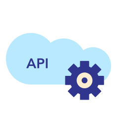
API Support
Additional support for External API calls for adding locations remotely (for instance, from mobile devices)
![]()
Application Design
We assist with implementing a new professional design on the section dedicated to the locations or routes
![]()
Map Tiles and Layers
Choose your base map tile and define additional map layers user can switch between
![]()
Tailored Search and Filters
Search, rank and filter locations and routes. Perfect for organizations with massive amounts of data
![]()
Custom Fields
Create custom fields to describe each location or route
![]()
Time Based Assets
Create time based assets and allow users to view map showing assets from a specific date
![]()
Users Can Edit and Suggest
Let users edit and suggest new locations or routes, given that you approve each request made
![]()
Community Plugins Integration
Integrate the solution with BuddyPress or PeepSo to facilitate your community mapping needs
Responsive
All maps and pages are responsive and can be used on mobile, desktop and tablets.
Process: How We Match Our Micro GIS Solution To Your Needs
![]()
Checking Requirements
Gather requirements, find gaps and prepare a plan
![]()
Developing Missing Components
We adjust our platform and add any missing functionality to match your requirements
![]()
Selecting the Tools
We choose from our wide range of existing plugins and proprietary modules
![]()
Testing
We run a live test to make sure it matches your initial requirements
Integration with 3rd Party
We integrate any required third-party API (Google Api, Weather and other related API)
![]()
Installation and Training
We install and configure our solution on your live environment and provide in-depth training on how to use it